Background
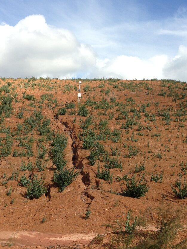
Okane was retained to complete a landform-scale erosion assessment on a mine rock stockpile (MRS) at a gold mine. The design principles and recommendations developed during the erosion assessment were also designed to guide future landform designs and rehabilitation at the site.
Approach
The project involved comparing estimated erosion rates for various potential outer embankment configurations using measured geotechnical characteristics of site materials. The assessment employed a combination of 3D and numerical modelling tools, including Civil3D, SIBERIA landform evolution modelling, and the Water Erosion Prediction Project (WEPP) model.
Client Benefit
Okane evaluated the performance of different embankment configurations on several MRSs with varying material properties. Better-performing embankment configurations were identified for further consideration. Modelling also indicated that a significant factor leading to the high erosion observed on the MRS was likely the result of landform-plateau surface water, contributing to incidental flows. This, in turn, caused ponding followed by crest overtopping and a series of cascading-type failures. Okane also provided surface water management recommendations to further improve the erosion performance of the preferred landform designs.

TastyCakes. Jamitzky. (2012). Syncrude Tailings Dam - Mildred Lake Settling Basin. Wikimedia.
Effective mine rock stockpile designs and surface water management strategies are achieved through landform evolution modelling.
Solutions
Case Studies
Other Projects
Discuss This Case Study
Future Proofing Mine Rock Landforms
Reach out to us at info@okaneconsultants.com for more information—we’d be happy to answer any questions you may have.
Let's Get In Touch
